- EUROPA
Route: https://goo.gl/maps/1opBspqVUchgqYsW9
This is the last day we were accompanied by a view of the fjords. As we will see later, although the nature of the landscape will change, it will not cease to impress. Central Norway is just as beautiful, which I must admit strongly surprised me. 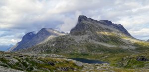
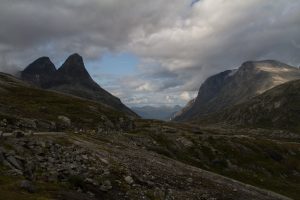 Farewell to the fjords was with a bump. The saturation of the national routes that day reached its zenith The first unforgettable impressions came with the inconspicuous descent from Road 15 to Gamle Strynefjellsvegen. I have read about this section in very few guidebooks. Also, I learned about this road from one of the reports. The road turned out to be another gem of our trip, also I sincerely recommend. It is largely gravel, but really well prepared. Even if someone hasn’t had the chance to drive off the asphalt until now, this will be a good and completely safe opportunity. Other than a puddle, you won’t encounter any surprises there. For that, there will be plenty of opportunities to stop and admire.
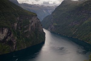
Some facts: Gamle Strynefjellsvegen is a road located in the western part of Norway. It connects the town of Videseter in the municipality of Stryn with the village of Grotli. The ride is 33 kilometers long and runs along a number of lakes. The highest point is 1139 meters above sea level. Stone boulders are placed on the side of the road. It’s not a high-mountain route, but it’s as stunning as many a route in the Alps. Construction of the road was completed in 1894 and was built entirely using only human hands. It was quite a convenience for traveling residents of western Norway. Until the early 20th century, other, much longer and more difficult routes were used to connect the west with the rest of the country. At the time, it was a masterpiece of road construction engineering.
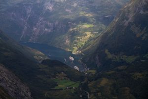 We said goodbye to this episode with regret. So far, it has been one of the few roads with such diversity. It offers exposure to both snow-capped mountain peaks, glaciers providing a backdrop of picturesque lakes, often the incredible colors of autumn flowers. Color palette. Even on such a cloudy, yet rainless day.
We continued past each other rushing towards the next viewpoint
Dalsnibba
(1495 mn.p.m.) The summit can be reached by asphalt. Entry is also paid for motorcycles (100NOK) However, it is worth taking advantage of. From the top, there is a view of the entire route traveled so far and a magnificent view of the glacier. From the top, you can also see Geirangerfjord and the road leading there in full glory. Hmm … the prospect of descending for a while froze us. But only for a while 😉
Here I will mention the fantastically profiled curves. All serpentines, tourist routes, are prepared in a very thoughtful way. Not infrequently they are also driven by coaches, which, as we personally observed, perfectly find a place to “fold up”. However, it is necessary to drive prudently. Especially on motorcycles. There have been cases when the coach driver, feeling bigger, caused the motorcyclist to be pushed to the side of the road. Behind the side of the road there is often nothing … We did not encounter such a situation. but rather forbearance and kind glances For our part, with a certain indulgence we observed situations when women instructed their men sitting in the car how to maneuver safely when parking or leaving the parking lot. It’s somehow a national tradition here. Not very effective 😉 Not infrequently we felt like replacing the driver and saving him and ourselves a lot of time 😉 We never dared.
Geirangerfjord was the last we saw on this trip. The town itself
Geiranger
is a very small village with only about 250 residents. In high season (May-early September), however, some 700,000 tourists pass through the town. They come here by car, bus, ferry and, of course, the big ocean-going tourist ships. Every year, some 200 of these colossi arrive at this tiny harbor, with nearly 350,000 cruise visitors aboard. Geiranger is their third stopping place in Norway, after Oslo and Bergen.
The village itself is classic: hotels, campgrounds, tourist information center, cafes, souvenir stores. This is the case in the center. Outside this area, it’s a different story. The first excursion boat cruise on the fjord took place in 1869. In 2005. Geiranger has been named the best destination in Scandinavia by Lonely Planet.
Geirangerfjord is 15 kilometers long and is surrounded by some of the steepest mountains on the entire west coast. In places, the depth of the Geirangerfjord reaches 700 meters. 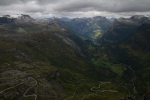
And one more story, which I will honestly say completely surprised me. Geiranger is under constant threat of an avalanche from a nearby mountain
Åkerneset
.
The effects of such an avalanche knocked me off my feet. At issue here is the risk of a tsunami being triggered by a falling boulder. Yes yes yes … tsunami. Currently under constant observation by geologists is a boulder that is 700m long, 1200m wide and 100m deep. Into the water it can collapse from 100m high. It is believed that such a collapse will cause a wave 80-120 meters high. A similar event has already occurred. April 7, 1934. from the Langhamaren mountain near Tafjord from an altitude of 730 meters, a rock fragment of about 3 million cubic meters fell into the water, causing a 62-meter flood wave. At the time, 40 people died as a result of the disaster. Scientists predict that as much as 100 million cubic meters of stone may fall away from Mount Åkerneset. From the moment the rock breaks off, Geiranger residents will have a maximum of 10 minutes to evacuate. Sirens will sound, and the automated system will call everyone with a warning and send a text message. Residents train for such a situation and know the evacuation routes.
The rock is already cracking. Today the gap in places is already a 30-meter trench filled with rubble. The rate of rock pushback in recent years has increased to about 20 cm per year. The question Geiranger residents are asking today is not WHAT boulder will fall off, but WHEN? In 2015, a disaster film was made under the title
The Wave (Bølgen)
, which tells the story of the possible consequences of such a disaster. I haven’t watched it yet, but after the information I’ve read I definitely will. It reportedly faithfully captures the horror of the situation and keeps you in suspense throughout.
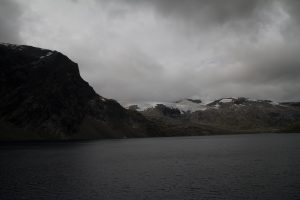 Well, fortunately, today you can still feel completely safe in these areas. From Geiranger we drove directly to the Troll Road (Trollstigen). The route itself between Geiranger and Trollstigen is also one of the 18 National Tourist Routes of Norway . It is also called the Golden Road. Its length is 104 kilometers and its maximum altitude is 1,038 meters above sea level.
However, before we reached the Golden Road we had the opportunity to drive along the Eagle Road and stop at the Bend of the same name. The road itself starts from the level of Geirangerfjord. It is formed by 11 very sharp turns climbing 620m above sea level. Here there is a viewing platform. Apparently, this route is open all year round. Also in winter. That’s why automotive molds use it to test cars in winter conditions.
Parking at the viewpoint is located just around the bend. What we found there exceeded our imagination. A dozen coaches, campers, motorcycles. All without order and composition. Everyone came, after all, just for a moment. Group guides exhorting their charges … a circus on wheels. And I mean that literally. More cars were coming from the top, they stopped increasing the congestion. However, they could not get through because their lane was occupied by pedestrians. We decided not to even try to squeeze somewhere in between this galimatia. We passed the parking lot completely and stuck to the guardrail already on the side of the road. We walked down 200m to the viewing platform. We took pictures, calmly returned to the motorcycles and easily left behind the coaches trying to get out of the jam. Motorcycles that were parked at the very beginning of the parking lot also unfortunately had to wait their turn to move on. 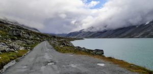
We set off in the direction of Trollstigen. The average slope of the road is 10%. It consists of 11 serpentines, most of which curve at 180°, so vehicles longer than 12.5 meters cannot travel on it. The highest point on the route is Stigrøra located 852 meters above sea level. The route was ceremonially opened on July 31, 1936 by King Haakon VII after 8 years of construction. It was built with the simplest tools (crowbar, pickaxe, shovel and wheelbarrow)
We stopped at one of the two viewpoints. Plattingen. From the platform you can see the road in all its glory. After today’s whole day, I can say with a clear conscience that the Troll Road is by all means a “must see” point. Nevertheless, it does not stand out from other such places as much as the guidebooks would indicate. A friend (not a motorcyclist) who saw the photo told me that someone must have had a wild imagination planning such a road. Hmm… I thought to myself that it would be lancer-like if it were straight 😉
 Meanwhile, we are slowly reaching our next overnight stay. Situated right next to the river. Nearby town of Andalsnes with a delicious Thai restaurant run by native Thais 😉 The town equipped with supermarkets, and those equipped with all kinds of beer, chocolate and cheese 😉 And… olives still and our favorite brown cherry tomatoes.
Apartment in the campground, own bathroom and kitchen. Price approx. 400 zł per suite/3 = 133 zł/os
Address: Gryttenveien 1, 6300 Åndalsnes 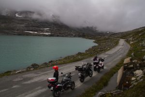
https://www.andalsnes-camping.net/apartment
Route: https://goo.gl/maps/d9uKLgyrZ74HQWNZ9
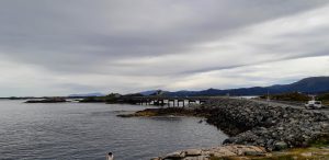
The Atlantic Road is a remarkable roadwork, forming a system of bridges and causeways over Hustadvika Bay. Driving it, one has the impression of traveling across the open ocean, and the most impressive is driving over the bridges during summer white nights, when the sun glides low over the horizon. I encountered such descriptions while preparing the trip. I tied my greatest expectations of the trip to it. However, it turned out to be the biggest disappointment for me. I point out that these are my subjective feelings, so it is always worth going and verifying it in person. After all, the British newspaper The Guardian named the Atlantic Road the world’s most beautiful car route.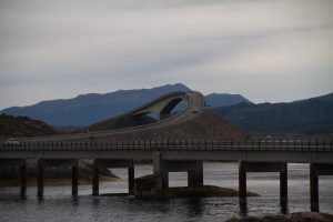
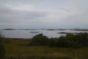
The Atlantic Road (Atlanterhavsvegen) is road 64 between Kristiansund and Molde. It runs through an archipelago of several small islands and skerries in Hustadvika Bay, an exposed part of the Norwegian Sea. It connects the island of Averøy to the mainland, between the towns of Karvåg and Vevang. The whole is based on a system of causeways, viaducts and eight bridges, the most prominent of which is the Storseisundet Bridge. And this one really impressed us.
 The largest city in the region is, Molde. Reportedly, a typical Norwegian, when asked about the associations that come to mind at the sound of the name Molde, will answer: jazz. An international jazz festival is held here once a year in June. It is the oldest jazz festival in Europe. It may be worthwhile to go here just then. It’s always a nice added bonus of the trip.
We drove from Molde to Kristiansund. It was the northernmost point of our trip. From here, the way back towards Oslo already begins. The town itself is full of colorful houses surrounding a small harbor. The city is located on four islands and is known for its rich cultural life and the Nordic Light photography festival highly regarded around the world. And for this one I would love to go, unfortunately, it is usually held in late April and early May, which is not a good time to go there by motorcycle.
To get to Kristiansund you have to go through a tunnel. First, the tunnel will lower its level by approx. 3 km in depth. At the end you have to cover the same distance going up. Navigation, of course, works all the time. It only showed that I was just going underwater. The rest was completed by my imagination. I was happy to go to the surface 😉 The impression is amazing. This was one place that, without offering views, was (literally) breathtaking. 
After leaving the tunnel, we hit the city right away. Again, a self-contained camping house. This time the standard is a little higher. Hmm … it took us a while to decipher how to run the water in the shower. Another moment how to make it warm, not hot 😉 There was an option to order breakfast, which, of course, we gladly took advantage of.
This is how photographic history was born here. A fixed point of the program – sending each other photos.
 The next day already leaving the city we had a cool adventure. We wanted to look at the gift store and couldn’t decipher the parking meter. This was looked at by a gentleman sitting in the car of their municipal police. And it lasted a good few minutes. Finally, Justina says: I’m going to go and tell him: either he will help us, or we leave the motorcycles without payment. The visitor saw what was happening and told him to follow. I will show you a free parking space, he said. So off we went. He pulled onto the boardwalk along the harbor and waved to follow him. Well… He stopped in front of a large garage door by the port itself. With a huge smile on his face, he says it’s here. I ask if they are sure. He assured us that this is his area and no one here will do anything to us.
  Oki… we did our business at the store. Back. And here the garage door is open, our guard is waiting with a colleague inside. Smiling and precocious (especially our guard), they invite you in. Everything became clear. This was their secret motorcycle pit. The men outdid themselves with stories about their hiding place. The focal point, of course, was the sofa overlooking the motorcycles, and next to it was the sideboard and its contents
Atlantel motel – price 710 PLN/3 = 237 PLN/person, rooms with bathrooms, 56 PLN optional breakfast. It looks good. Address: Dalaveien 22, 6511 Kristiansund 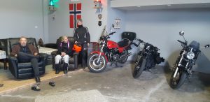
TAKE IT IZI Foundation
Newsletter
Subscribe to stay up to date